![](/images/other/stat-length.png)
![Randonnée A pied Gemeinde Warth - Mostheurigen Weg (Ausgangspunkt: Kirchau Kirchenplatz) - Photo](https://media.geolcdn.com/t/1900/400/f18e4c43-4b4a-4f9e-bbcf-a15e87308003.jpeg&format=pjpeg&maxdim=2)
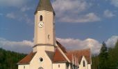
Mostheurigen Weg (Ausgangspunkt: Kirchau Kirchenplatz)
SityTrail - itinéraires balisés pédestres
Tous les sentiers balisés d’Europe GUIDE+
![Longueur](/images/other/stat-length.png)
Longueur
9,4 km
![Altitude max](https://static1.geolcdn.com/siteimages/upload/files/1508320355ic_sort_altitude_max_24dp.png)
Altitude max
691 m
![Dénivelé positif](https://static1.geolcdn.com/siteimages/upload/files/1508320355ic_sort_den_pos_24dp.png)
Dénivelé positif
329 m
![Km-Effort](/images/other/stat-length.png)
Km-Effort
13,8 km
![Altitude min](https://static1.geolcdn.com/siteimages/upload/files/1508320355ic_sort_altitude_min_24dp.png)
Altitude min
429 m
![Dénivelé négatif](https://static1.geolcdn.com/siteimages/upload/files/1508320355ic_sort_den_neg_24dp.png)
Dénivelé négatif
329 m
![Boucle](https://static1.geolcdn.com/siteimages/upload/files/16400158638029165_repeat_loop_refresh_sync_direction_icon.png)
Boucle
Oui
Balise
Date de création :
2022-02-16 16:46:56.815
Dernière modification :
2022-03-03 11:54:12.764
![A pied](https://static1.geolcdn.com/sitytour/trail-icons/100.png)
3h08
Difficulté : Facile
![Scannez ce code QR pour ouvrir la randonnée dans l'application SityTrail](https://capi.geolives.com/qq0zvz2zws4bq2lad0pu/sitytour/trails/3127846/qr.png?size=200)
Application GPS de randonnée GRATUITE
À propos
Randonnée A pied de 9,4 km à découvrir à Basse-Autriche, Bezirk Neunkirchen, Gemeinde Warth. Cette randonnée est proposée par SityTrail - itinéraires balisés pédestres.
Description
Randonnée créée par DEV Kirchau.
Symbole: roter Punkt auf weißem Grund
Localisation
Pays :
Autriche
Région :
Basse-Autriche
Département/Province :
Bezirk Neunkirchen
Commune :
Gemeinde Warth
Localité :
Unknown
Départ:(Dec)
Départ:(UTM)
581961 ; 5278601 (33T) N.
Commentaires
Randonnées à proximité
![Randonnée A pied Gemeinde Thomasberg - Grimmenstein - Kulmriegel - Landeskrankenhaus Grimmenstein - Hochriegel - Photo](https://media.geolcdn.com/t/375/260/607745ab-90e6-40df-9e2e-ad37d487f721.jpeg&format=jpg&maxdim=2)
![A pied A pied](https://static1.geolcdn.com/sitytour/trail-icons/100.png)
Grimmenstein - Kulmriegel - Landeskrankenhaus Grimmenstein - Hochriegel
A pied
Facile
Gemeinde Thomasberg,
Basse-Autriche,
Bezirk Neunkirchen,
Autriche
![](/images/other/stat-length.png)
7,6 km | 12,2 km-effort
2h 47min
![](https://static1.geolcdn.com/siteimages/upload/files/16400158638029165_repeat_loop_refresh_sync_direction_icon.png)
Non
![Randonnée A pied Gemeinde Seebenstein - Pittental Hochwechsel Rundwanderweg 3 - Photo](https://media.geolcdn.com/t/375/260/bec888b9-de6c-4918-847c-285910c1a278.jpeg&format=jpg&maxdim=2)
![A pied A pied](https://static1.geolcdn.com/sitytour/trail-icons/100.png)
Pittental Hochwechsel Rundwanderweg 3
A pied
Facile
Gemeinde Seebenstein,
Basse-Autriche,
Bezirk Neunkirchen,
Autriche
![](/images/other/stat-length.png)
13,1 km | 19,6 km-effort
4h 27min
![](https://static1.geolcdn.com/siteimages/upload/files/16400158638029165_repeat_loop_refresh_sync_direction_icon.png)
Oui
![Randonnée A pied Gemeinde Warth - Kulmer Weg (Ausgangspunkt: Kirchau Kirchenplatz) - Photo](https://media.geolcdn.com/t/375/260/f18e4c43-4b4a-4f9e-bbcf-a15e87308003.jpeg&format=jpg&maxdim=2)
![A pied A pied](https://static1.geolcdn.com/sitytour/trail-icons/100.png)
Kulmer Weg (Ausgangspunkt: Kirchau Kirchenplatz)
A pied
Facile
Gemeinde Warth,
Basse-Autriche,
Bezirk Neunkirchen,
Autriche
![](/images/other/stat-length.png)
7,2 km | 10,2 km-effort
2h 18min
![](https://static1.geolcdn.com/siteimages/upload/files/16400158638029165_repeat_loop_refresh_sync_direction_icon.png)
Oui
![Randonnée A pied Gemeinde Warth - Orchideen Weg (Ausgangspunkt: Warth Hauptplatz) - Photo](https://media.geolcdn.com/t/375/260/970ab4d4-72c1-417a-a00d-aa9297c367b1.jpeg&format=jpg&maxdim=2)
![A pied A pied](https://static1.geolcdn.com/sitytour/trail-icons/100.png)
Orchideen Weg (Ausgangspunkt: Warth Hauptplatz)
A pied
Facile
Gemeinde Warth,
Basse-Autriche,
Bezirk Neunkirchen,
Autriche
![](/images/other/stat-length.png)
9,7 km | 15,1 km-effort
3h 25min
![](https://static1.geolcdn.com/siteimages/upload/files/16400158638029165_repeat_loop_refresh_sync_direction_icon.png)
Oui
![Randonnée A pied Gemeinde Warth - Leidinger Weg (Ausgangspunkt: Petersbaumgarten Kapellenplatz) - Photo](https://media.geolcdn.com/t/375/260/158a56e6-c9c6-4d07-b8a5-485fd0302378.jpeg&format=jpg&maxdim=2)
![A pied A pied](https://static1.geolcdn.com/sitytour/trail-icons/100.png)
Leidinger Weg (Ausgangspunkt: Petersbaumgarten Kapellenplatz)
A pied
Facile
Gemeinde Warth,
Basse-Autriche,
Bezirk Neunkirchen,
Autriche
![](/images/other/stat-length.png)
7,1 km | 10,3 km-effort
2h 20min
![](https://static1.geolcdn.com/siteimages/upload/files/16400158638029165_repeat_loop_refresh_sync_direction_icon.png)
Oui
![Randonnée A pied Gemeinde Warth - Gretel Weg (Ausgangspunkt: Warth Bushaltestelle) - Photo](https://media.geolcdn.com/t/375/260/970ab4d4-72c1-417a-a00d-aa9297c367b1.jpeg&format=jpg&maxdim=2)
![A pied A pied](https://static1.geolcdn.com/sitytour/trail-icons/100.png)
Gretel Weg (Ausgangspunkt: Warth Bushaltestelle)
A pied
Facile
Gemeinde Warth,
Basse-Autriche,
Bezirk Neunkirchen,
Autriche
![](/images/other/stat-length.png)
3,4 km | 6,2 km-effort
1h 24min
![](https://static1.geolcdn.com/siteimages/upload/files/16400158638029165_repeat_loop_refresh_sync_direction_icon.png)
Non
![Randonnée A pied Gemeinde Thomasberg - Friedbachweg (Grimmenstein) - Dermahof - Photo](https://media.geolcdn.com/t/375/260/be9786a8-b70b-4eff-bf77-04bc30075bbd.jpeg&format=jpg&maxdim=2)
![A pied A pied](https://static1.geolcdn.com/sitytour/trail-icons/100.png)
Friedbachweg (Grimmenstein) - Dermahof
A pied
Facile
Gemeinde Thomasberg,
Basse-Autriche,
Bezirk Neunkirchen,
Autriche
![](/images/other/stat-length.png)
3,7 km | 7,2 km-effort
1h 38min
![](https://static1.geolcdn.com/siteimages/upload/files/16400158638029165_repeat_loop_refresh_sync_direction_icon.png)
Non
![Randonnée A pied Gemeinde Warth - Urbankapelle -Ödenkirchen - Rams - Raach - Schlagl - Maria Schutz - Photo](https://media.geolcdn.com/t/375/260/8cb61248-f720-4028-a202-b65a40f0f104.jpeg&format=jpg&maxdim=2)
![A pied A pied](https://static1.geolcdn.com/sitytour/trail-icons/100.png)
Urbankapelle -Ödenkirchen - Rams - Raach - Schlagl - Maria Schutz
A pied
Facile
Gemeinde Warth,
Basse-Autriche,
Bezirk Neunkirchen,
Autriche
![](/images/other/stat-length.png)
10,6 km | 14,4 km-effort
3h 15min
![](https://static1.geolcdn.com/siteimages/upload/files/16400158638029165_repeat_loop_refresh_sync_direction_icon.png)
Non
![Randonnée A pied Gemeinde Warth - Haßbach - Ödenkirchen - Photo](https://media.geolcdn.com/t/375/260/f3dac0c1-1617-42b2-b198-f8316af0fe29.jpeg&format=jpg&maxdim=2)
![A pied A pied](https://static1.geolcdn.com/sitytour/trail-icons/100.png)
Haßbach - Ödenkirchen
A pied
Facile
Gemeinde Warth,
Basse-Autriche,
Bezirk Neunkirchen,
Autriche
![](/images/other/stat-length.png)
4 km | 7,8 km-effort
1h 47min
![](https://static1.geolcdn.com/siteimages/upload/files/16400158638029165_repeat_loop_refresh_sync_direction_icon.png)
Non